

Quick answer
Walking Hong Kong costs 0 HKD — free access to public streets and sidewalks — and the routes are open 00:00–23:59, seven days a week, since they run on open pavement rather than a ticketed site. The recommended arrival window is 09:00–17:00 for optimal daylight for photography and manageable crowd levels. Humidity, not distance, is the limiting factor in summer.
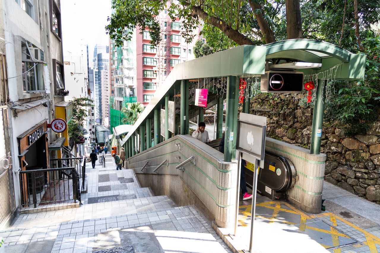
Central and Western District rises roughly 100 metres in under a kilometre, which is why the neighbourhood's defining piece of infrastructure is an escalator. The Central–Mid-Levels Escalator runs downhill until around 10:00, then reverses uphill for the rest of the day — a detail that quietly reshapes any hong kong walking tour map drawn without it. Route planners who ignore the direction change end up climbing Shelley Street on foot in August humidity. What a reader is actually dealing with here is overlap. The Sun Yat-sen Historical Trail, the Dr Sun Yat-sen Museum on Castle Road, Man Mo Temple on Hollywood Road, Tai Kwun's former Central Police Station compound, PMQ, Graham Street Market and the antique shops of Upper Lascar Row all sit within the same handful of blocks. Several published Hong Kong Island landmarks routes cross the same intersections in opposite directions. The result is that no single line is authoritative; the useful question is which sequence keeps the gradient in your favour and the sun off your neck. The geography explains the answer. Streets in this district run either along the contour — Queen's Road Central, Hollywood Road, Caine Road — or straight up it, as the stepped ladder streets do. A self-guided Hong Kong tour that alternates between the two, using contour streets for distance and the escalator or a stepped lane for height, converts a strenuous climb into a manageable stroll. 中環半山扶手電梯, the Chinese name locals use for that escalator, marks the spine most routes hang from. Use the map as a filter rather than an itinerary. Mark the fixed points that matter to you — a temple, a market, a colonial-era compound — then let the contour lines decide the order. Covered walkways above Connaught Road and the shaded arcades of Des Voeux Road offer bail-out options when a thunderstorm arrives, which in August it frequently does. Treated this way, a hong kong walking tour map stops being a route to follow and becomes a set of exits, shortcuts and vertical shortcuts you can take at will, which is the only realistic way to walk a city built on a slope.
“No single line is authoritative; the useful question is which sequence keeps the gradient in your favour.”
Suggested Routes for Your Hong Kong Walking Tour Map
This plan suits first-time visitors covering Central and Western District on foot at a steady pace, using the 09:00–17:00 arrival window for daylight and manageable crowds. Allow roughly seven hours end to end, including rest stops.
Start at Statue Square
Begin in Central at Statue Square and the Court of Final Appeal Building, allowing 30 minutes to orient yourself and read the colonial-era facades before pedestrian traffic builds.
Climb to Tai Kwun
Walk uphill via Battery Path to Tai Kwun, the former Central Police Station compound on Hollywood Road. Budget 90 minutes for the Parade Ground, Victoria Prison cells and rotating gallery spaces.
Ride the Mid-Levels Escalator
Follow the Central–Mid-Levels Escalator north through SoHo, stepping off at Staunton and Elgin Streets. The escalator runs uphill only after 10:00, so plan the descent on foot.
Lunch break in SoHo
Stop for an hour around Gough Street or Peel Street, where cha chaan teng and small kitchens sit within a few minutes' walk of the escalator exits.
Man Mo Temple and Hollywood Road
Descend to Man Mo Temple, then browse the antique shops along Hollywood Road and Upper Lascar Row. Roughly 75 minutes; incense smoke inside the temple is heavy, so pause outside if sensitive.
Sheung Wan and Western Market
Continue west through Possession Street to Des Voeux Road West and the dried seafood stalls, finishing at Western Market. Around 60 minutes at an easy pace.
Finish at the harbourfront
Loop back along Connaught Road to the Central Ferry Piers and the harbour promenade, a 20-minute level walk that closes the route near MTR and ferry connections.
Accessing Your Hong Kong Walking Tour Map Start Point
The Central and Western District serves as the primary hub for walking tours, easily accessible via Hong Kong's comprehensive public transport network. The MTR remains the most efficient way to reach the starting points within the district.
Island Line to Central Station
Hong Kong Tramways to Central stop
Star Ferry from Tsim Sha Tsui to Central Pier
Direct to Central and Western District
Entrance Fees and Costs for a Hong Kong Walking Tour Map
Walking tours throughout the Central and Western District utilize public streets and sidewalks, which do not require tickets. Costs only apply if you choose to book private guided services.
A typical adult pays 0 HKD for self-guided exploration, with costs only incurred if selecting external guided tour packages.
Photogenic Landmarks on Your Hong Kong Walking Tour Map
Pottinger Street
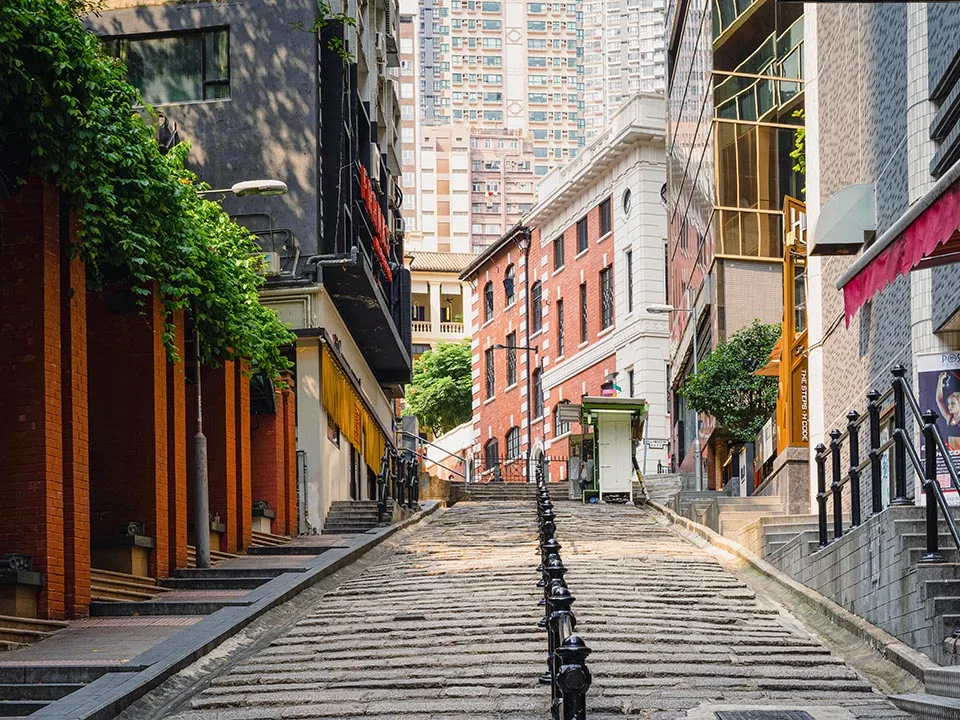
Capture the historic granite stone steps and street-level market stalls framed by high-rise buildings.
Man Mo Temple
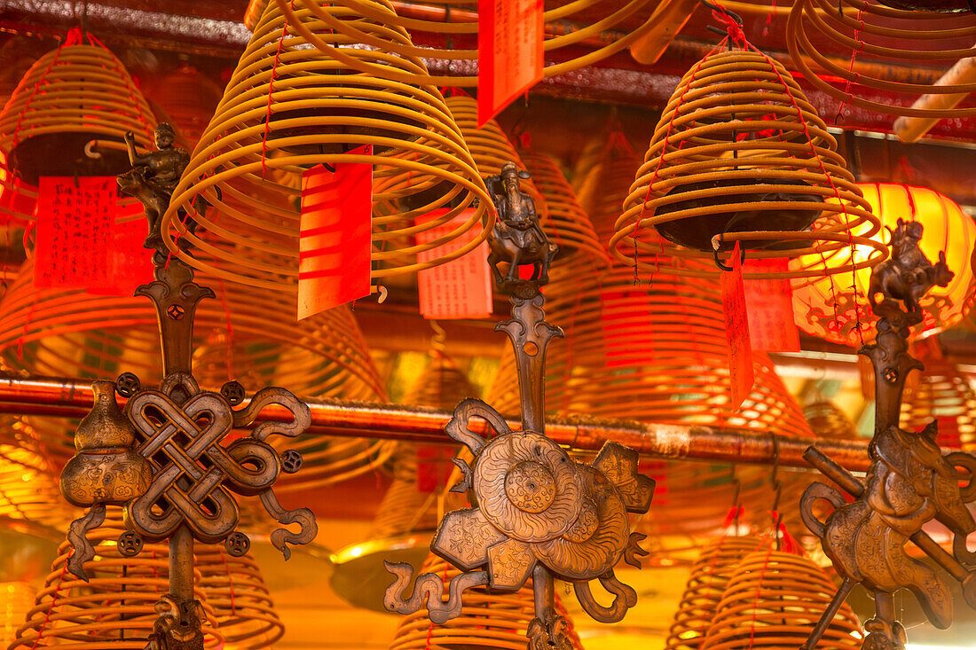
Focus on the hanging incense coils and the contrast of light filtering through the temple ceiling.
Tai Kwun
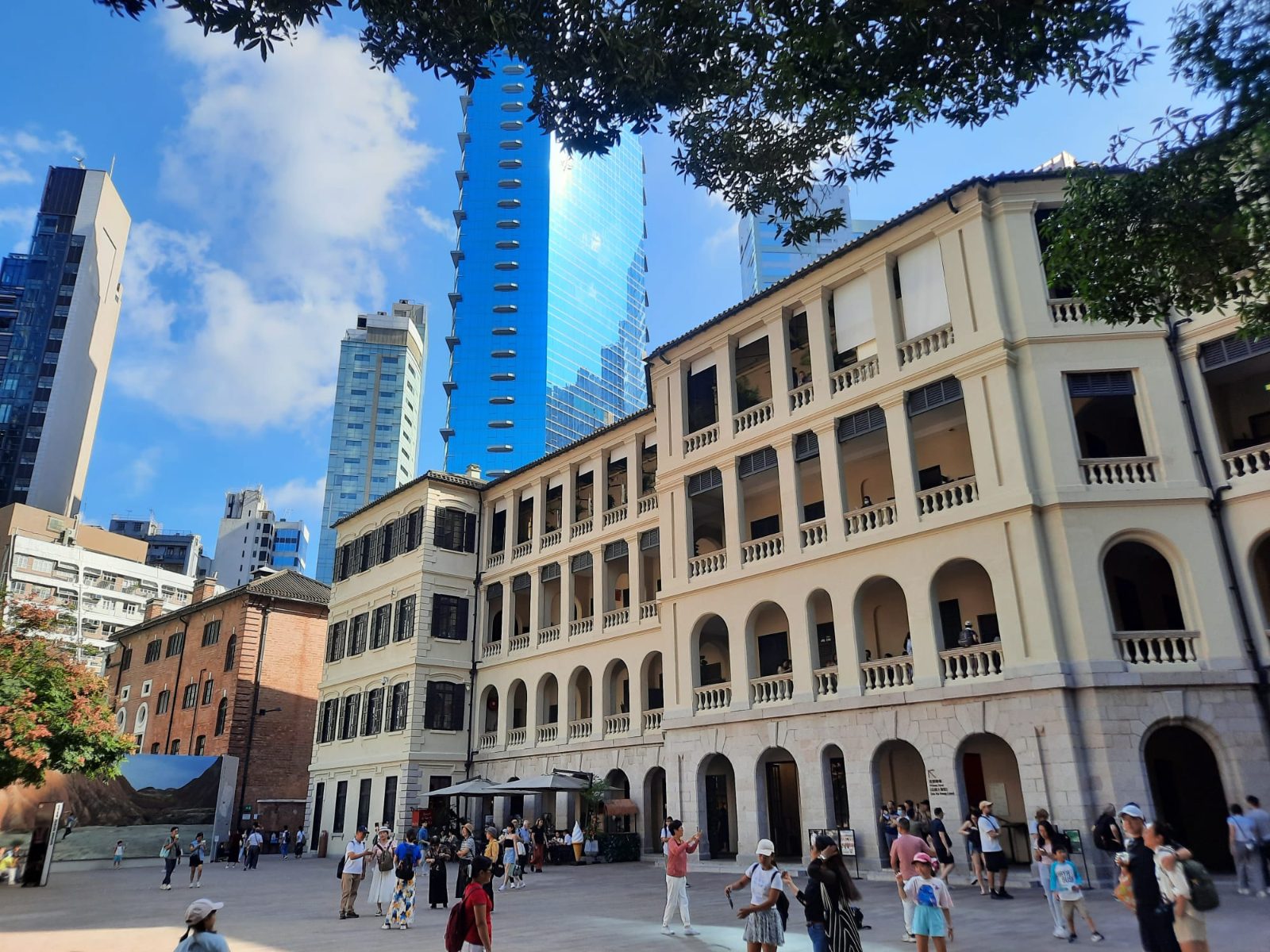
Photograph the contrast between the preserved colonial architecture and the contemporary JC Contemporary gallery.
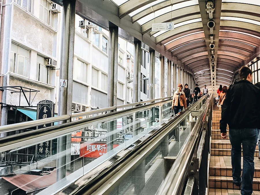
Mid-Levels Escalators
Frame the long, covered escalator system moving through the dense urban landscape of the district.
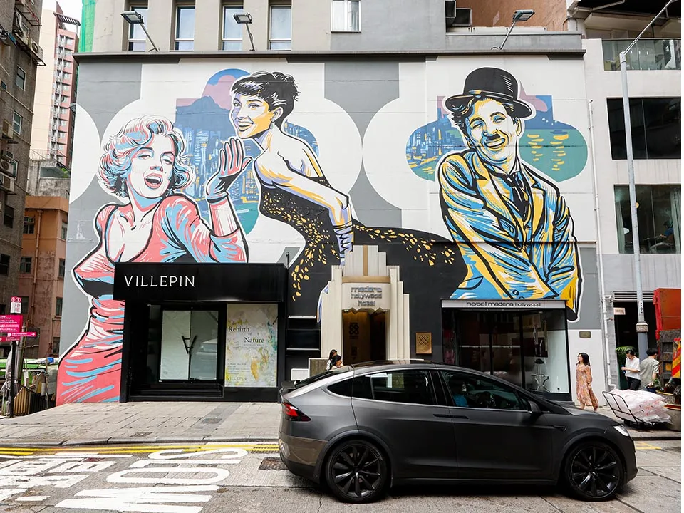
Hollywood Road
Shoot the vibrant street art murals set against traditional antique shop fronts.
Preparation Checklist for Your Hong Kong Walking Tour Map
A self-guided walk through Central and Western District rewards a little preparation, so sort these out in the weeks and days before you set off.
-
Download an offline map — Street-level signal drops between tall buildings and covered walkways.
-
Load an Octopus card in advance — Trams, ferries and the MTR between walk segments accept it without queuing.
-
Check the typhoon and rainstorm signal — Warnings can close outdoor stretches and escalator links at short notice.
-
Break in flat, grippy shoes — Central is built on a slope, with steep lanes and long stair runs.
-
Pack a compact umbrella and light layers — Humidity, sudden showers and hard air conditioning all appear in one afternoon.
-
Carry a power bank and refillable bottle — Navigation drains phones fast and refill points are limited on side streets.
-
Bring photo ID and a small amount of cash — Older market stalls and dai pai dongs often decline cards.
-
Start within the 09:00–17:00 window — Daylight holds and crowds stay manageable across the district.
Check availability
Frequently asked questions about hong kong walking tour map
Everything you need to know about hong kong walking tour map